

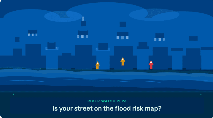
River Watch 2026 is now active. Monitoring stations along major waterways are tracking water levels in real time, and emergency management teams are updating flood risk maps to reflect current ground conditions — including areas that may not have flooded in recent memory but now face elevated risk due to development, drainage changes, and shifting weather patterns.
What the flood risk map actually means
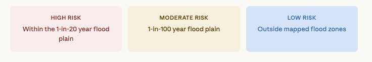
Flood risk maps divide communities into zones based on probability — not certainty. A high-risk designation means a property has a roughly 1-in-4 chance of flooding at least once during a 30-year mortgage period. That’s a meaningful number. And with climate-driven rainfall becoming less predictable, some neighbourhoods previously considered low-risk are now finding themselves reclassified.
How to check your address
Checking whether your property falls within a risk zone takes about two minutes. Your municipal emergency management office maintains a publicly accessible mapping tool — search for your address and you’ll see the zone designation, any updated risk level from this year’s assessment, and nearby waterway monitoring points.
If you’re in a rental, your landlord is required to disclose flood zone status in most provinces — but checking yourself is faster and more reliable than waiting to be told.
Not in a high-risk zone? That’s good news — but don’t stop there. About 25% of flood insurance claims come from properties outside designated high-risk areas. Surface flooding from overwhelmed storm drains can happen almost anywhere.
Five things to do this week
- Check the River Watch 2026 map for your street and save a screenshot. (https://www.gnb.ca/en/emergency/river-watch.html)
- Review your home insurance policy — standard policies typically exclude overland flooding.
- Clear your downspouts, gutters, and window wells before the next rain event.
- Move valuables and important documents to an upper floor or waterproof container.
- Sign up for emergency alerts from your municipality — River Watch issues updates when river levels cross thresholds.
The bigger picture
River Watch isn’t just a seasonal ritual. It reflects a growing awareness among planners and emergency managers that flood risk in many communities is rising — and that the maps from a decade ago may no longer tell the full story. New modelling is being incorporated that accounts for stormwater system capacity, upstream development, and changing precipitation patterns.
If your neighbourhood has changed significantly in the last few years — new subdivisions upstream, removed green space, road expansions — it may be worth requesting a reassessment through your local planning office, even if your current zone designation looks fine.
