


New Brunswick·New
A team of researchers in New Brunswick is using satellite technology and artificial intelligence to help foresters identify and avoid cutting old forests that provide critical habitats to species like bats and chimney swifts.
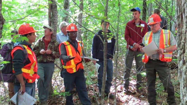
Data will be used to create a live map for foresters, identifying areas to avoid harvesting

Isabelle Leger · CBC News
· Posted: Oct 12, 2025 5:00 AM EDT | Last Updated: 27 minutes ago
 The team at the Northern Hardwoods Research Institute in Edmundston is spending 18 to 24 months using satellite tech and AI to build useful tools to keep critical habitats in old forests from harm. (Submitted by Jennifer Saunders )
A New Brunswick-led research project is using satellite imaging and artificial intelligence to find and predict where old forests are, in an effort to develop better management practices for the forestry sector.
Northern Hardwoods Research Institute is leading the project, with funding from the Canadian Space Agency, from its Edmundston facility. The team will use data from satellites that fly over the same forested area each week.
Gaetan Pelletier is the institute’s executive director. He said the goal is to provide forestry managers with the tools to protect old forests that have rich and complex ecosystems crucial to the survival of some species.
“They are special ecosystems and today we’re not equipped with the technology or tools to find out where they are before we enter an area and conduct harvesting,” Pelletier told CBC Radio’s Information Morning Fredericton.
This story was brought to Nouzie by RSS. The original post can be found on https://www.cbc.ca/news/canada/new-brunswick/northern-hardwoods-research-institute-old-forest-critical-habitat-canadian-space-agency-9.6931814?cmp=rss
